
A Large Scale Flight Campaign for Agricultural Mapping in Germany
flyXdrive and GAF AG, an e-GEOS (Telespazio/ASI) company, have achieved one of the largest and fastest land use mapping projects in a German federal state to date.
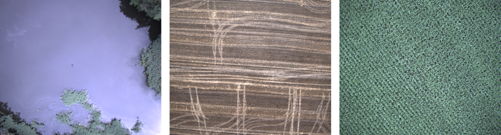
This summer, in July, flyXdrive generated a total of 24 000 images covering the complete state of Saxony for the automatic monitoring of agricultural parcels in the context of the EU‘s Common Agricultural Policy (CAP).
GAF AG contributed to “controls for direct payments and area-related agricultural support measures” for the Saxon Ministry of Energy, Climate Protection, Environment and Agriculture (SMEKUL) by using satellite image evaluation, its cloud-based AI solution AgroCrop® and, for the first time, the highest-resolution drone images. As part of this project, flyXdrive, assisted by RWTH Aachen University, carried out flights with unmanned aircraft systems (UAS) over the entire state of Saxony throughout the day for the short period of one month only to collect agricultural data. The result: 297 flights, four flight systems in parallel operation, a total flight distance of 10 300 km, and 24 000 images taken.
Our parts as drone specialist were the area-wide flight operation with our TW-Neo. This includes operational authorisation in the specific category for BVLOS flights, clustering of flight routes, airspace integration and of course flight operation.
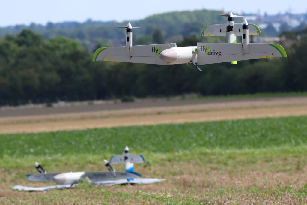
The German Federal Aviation Office (LBA) issued flyXdrive an approval for drone flights beyond visual range across an entire federal state. The flights were carried out automatically and observed by remote pilots in Aachen.
Many thanks to GAF AG from Munich for the exellent cooperation in this large scale flight campain.
Also many thanks to the Institute of Flight System Dynamics RWTH Aachen University supporting us in this endeavour .
Further Information: Press release